Project Profile: Green Infrastructure Bioswale Project in Harris County, TX (Source: Stormwater)
The Harris County Flood Control District (HCFCD) is a special purpose district created by the Texas Legislature in 1937 in response to devastating floods that struck the Houston region in 1929 and 1935. HCFCD’s jurisdictional boundaries are set to coincide with Harris County, a community of more than 4.5 million people (as of 2015) that includes the City of Houston. The other boundaries in which HCFCD operates are the 22 primary watersheds within Harris County’s 1,777-square-mile area.
HCFCD’s drainage and flood control infrastructure are extensive, including more than 1,500 channels and totaling 2,500 miles in length (about the distance from Los Angeles to New York). The flat terrain is made up of clay soils that do not absorb water very well, and the average annual rainfall for the area is 48 inches
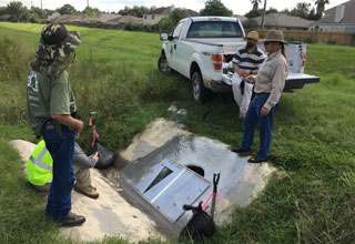
A typical design of many HCFCD channels includes a maintenance berm on top of a channel bank with backslope swale and interceptor pipes to capture sheet flow coming toward the channel. The purpose of this backslope interceptor system is to avoid scouring from stormwater runoff coming down the slope of the channel. As shown in Figure 5, the backslope swales are typically turf grass-lined and the interceptor pipes are typically 24-inch corrugated metal pipes (CMP) with a V-shape concrete structure. Under its National Pollutant Discharge Elimination System stormwater permit, HCFCD must develop and implement a storm water management program that addresses pollutant discharges from areas of new development and significant redevelopment. Stormwater best management practices (BMP) are commonly used by HCFCD to manage runoff and improve water quality.
A Pilot Project
HCFCD is studying the potential of converting a typical backslope swale into a bioswale BMP because of limited space within HCFCD’s channel right-of-way to install other types of BMPs. A BMP performance demonstration project was therefore conducted to evaluate the effectiveness and practicability of modifying a HCFCD-owned, managed, and maintained backslope drainage system into a bioswale BMP that meets Green Infrastructure (GI) criteria.
A monitoring plan and quality assurance project plan (QAPP) was developed to define requirements for conducting field sampling and data management for evaluating the effectiveness of the bioswale BMP. The purpose of the QAPP is to clearly define the quality assurance/quality control (QA/QC) requirements, management structure of the monitoring organizations, and procedures that will be followed to implement the QA/QC requirements necessary to verify and validate the data collected for the project. Lockwood, Andrews & Newnam Inc. (LAN), a national planning, engineering, and program management firm, was contracted by HCFCD to develop the QAPP, and TestAmerica, an environmental testing laboratory group, was selected to analyze the collected water samples.
CLICK HERE TO READ COMPLETE STORY