Halls Bayou Watershed Study – Harris County Flood Control District
Houston Texas
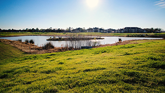
Halls Watershed is an accelerated flood damage reduction for 45 square miles of Halls Bayou watershed to serve as the accepted comprehensive regional plan for providing flood risk mitigation. As part of this study, LAN performed an extensive modeling effort to quantify various combinations of Vision Plan scenarios that maximize hydraulic benefits, subject to cost and ROW constraints. LAN shifted the hydraulic modeling framework from a 1D mainstem-only approach, towards a watershed-wide 1D/2D dynamic model to improve accuracy. This allows for the dynamic routing of storm event flood waves, inter-watershed overflows, and tailwater considerations in the presence of proposed and interconnected regional detention basins. This improved modeling approach provided a reliable platform for high-level understanding on the analyses of various Vision Plan alternatives.
Development of the watershed-wide Baseline Conditions model entailed the retrofitting of the Effective M3 model to include nine unstudied tributaries. 2D modeling was also used to quantify flow exchanges from neighboring channels and sub-catchments. Throughout this Vision Plan formulation process LAN has developed a preliminary set of modeling guidelines for analyzing unstudied tributaries with 2D techniques. In total, including baseline conditions and two storm events, LAN developed a total of 17 unique 1D/2D dynamic model runs for the watershed.
At a glance
45 square-mile watershed
17 unique 1D/2D dynamic model runs
9 unstudied tributaries
Features
Watershed-wide 1D/2D dynamic model
Interconnected regional detention basins
Development of preliminary modeling guidelines
Services
1D/2D dynamic modeling
Watershed master planning
Stormwater management
Client
Harris County Flood Control District
Stormwater and Drainage
Stormwater Management