From Flood Corridor to Community Park: Maximizing the Value of Urban Stream Improvements
By Laura Casset, PE, CFM, CPESC and Amir Ahmadi, PhD, PE, CFM
Urban creek projects often begin with a specific need: reduce flooding, stabilize an eroding channel or protect nearby infrastructure. But a creek corridor rarely serves only one purpose. It may also contain roads, utilities, habitat, trails, parks and connections between neighborhoods.
When municipalities consider these systems together, one major infrastructure investment can address several community needs. The City of San Marcos’ Purgatory Creek Channel Improvement Project demonstrates this approach by combining flood mitigation with stream restoration, infrastructure improvements and recreational parkland.
Rather than treating these as separate efforts, the City is planning Purgatory Creek as an interconnected infrastructure, environmental and community system. The project offers a model for how municipalities can make public investments work harder by coordinating improvements that might otherwise be planned independently.
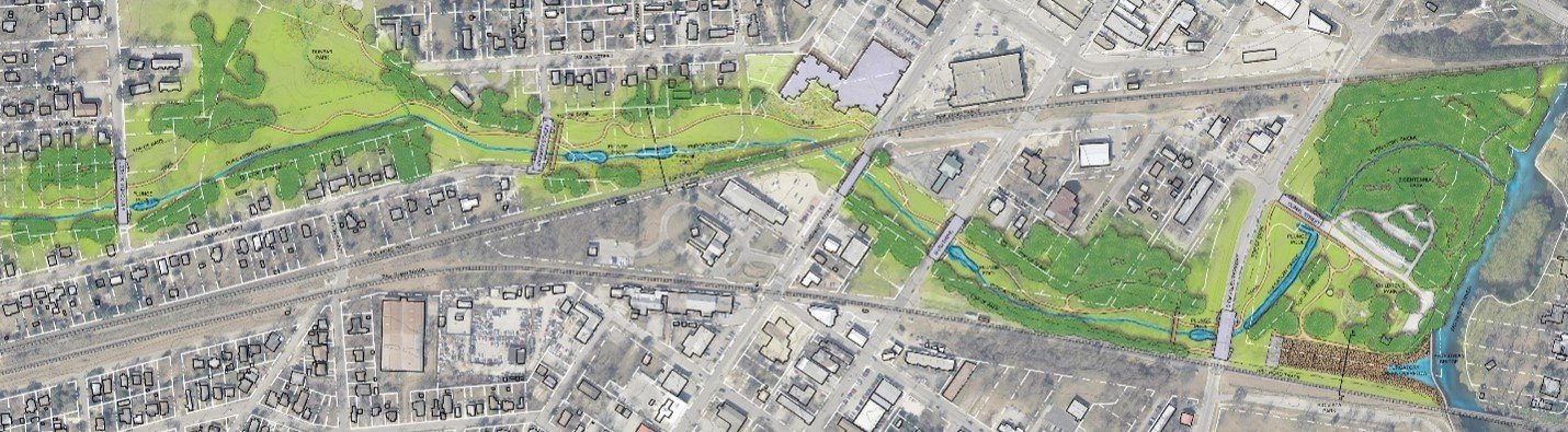
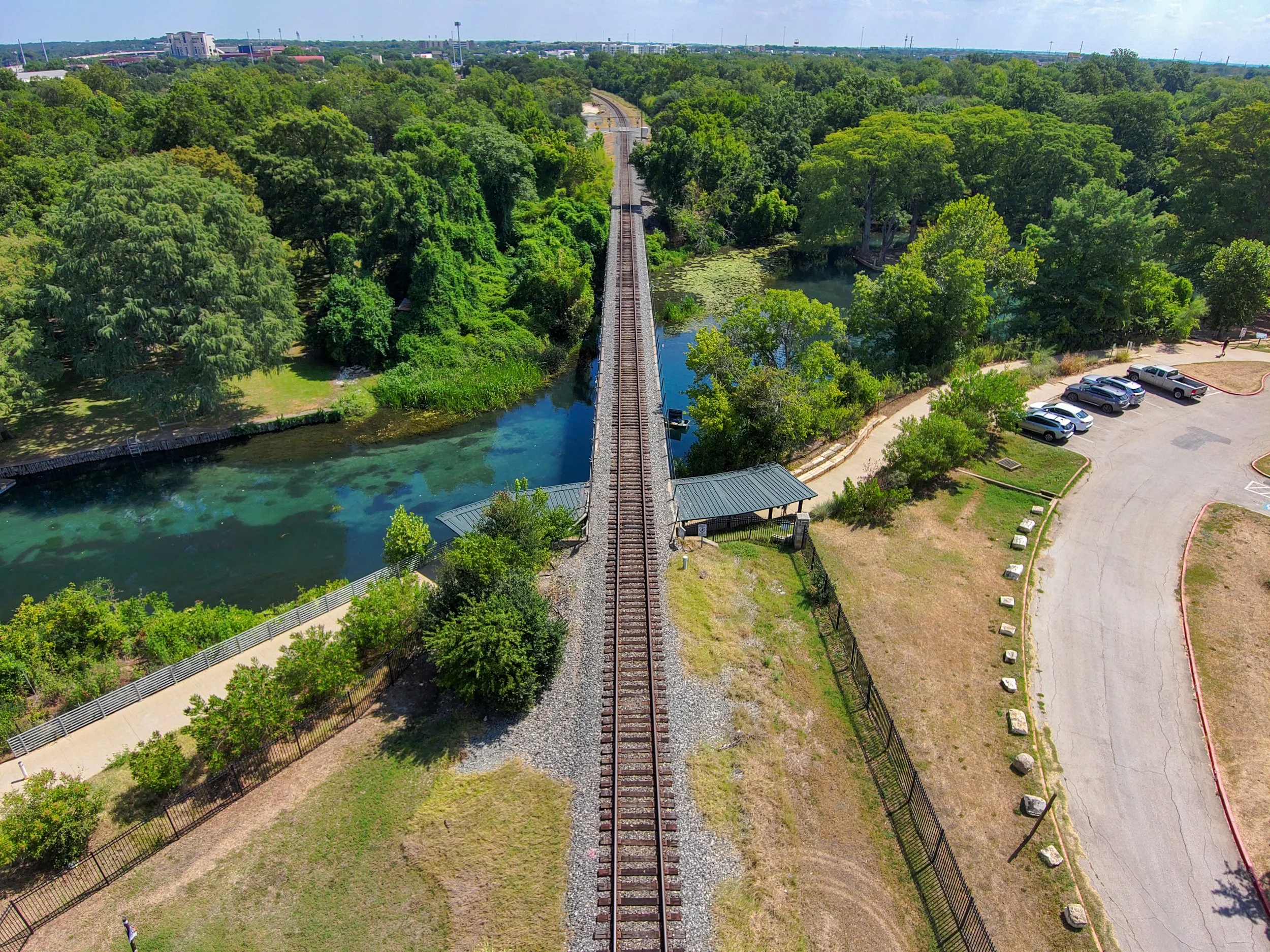
The Purgatory Creek Channel Improvement Project integrates flood mitigation, natural channel restoration, infrastructure improvements and public open space within an urban San Marcos corridor.
Evaluating the Creek as a System
Effective channel restoration begins with understanding why a creek behaves as it does. Visible erosion or flooding may reflect broader changes in runoff, sediment movement, channel geometry or surrounding development.
LAN’s channel restoration process begins with identifying root causes and understanding the creek’s history. Desktop research using historical aerial imagery, soils and topography is paired with field reconnaissance and geomorphic assessment. Hydrologic and hydraulic modeling, sediment transport analysis and scour analysis then help the team evaluate alternatives suited to the site. Construction sequencing, permitting, vegetation establishment and long-term maintenance are also considered.
For Purgatory Creek, the project team combined hydrologic and hydraulic modeling with geomorphic, ecological, geotechnical, landscape, soil, utility, roadway and trail assessments. The team also studied reference streams and existing portions of the creek to identify stable characteristics that could inform the proposed design.
This broader investigation allowed the team to evaluate the creek as more than a drainage facility and coordinate flood performance, channel stability, infrastructure, environmental priorities and public use.
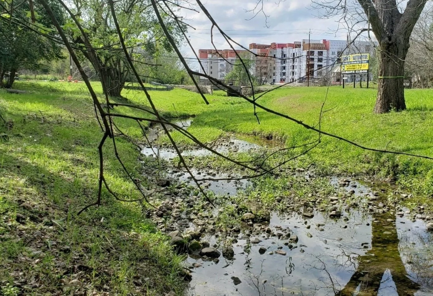
The project team studied existing pool-riffle-run conditions in Purgatory Creek to help establish stable characteristics for the proposed pilot channel.
Coordinating Complementary Goals
Purgatory Creek illustrates how coordinating related goals can help maximize the value of a public investment. Its scope includes natural channel design, flood mitigation, bridge improvements, storm sewer outfall adjustments, local drainage projects, utility coordination, trails, pedestrian connections, landscaping and environmental permitting.
Considering these components together allows each decision to be evaluated against the corridor’s broader needs. A bridge improvement, for example, can affect transportation, flood conveyance, emergency access, scour, utilities and pedestrian connectivity. Native vegetation can contribute to slope stability, habitat, water quality and the public experience of the corridor.
The investment is maximized not by adding unrelated amenities, but by selecting improvements that perform several compatible functions.
Restoring Stream Function
At the center of the project is the proposed widening and restoration of approximately two miles of Purgatory Creek. The natural channel design includes a meandering pilot channel, pool-riffle-run sequences, native vegetation, riparian planting areas and wetland features.
These elements are intended to help the creek convey channel-forming flow and move sediment while maintaining a broader corridor for larger storm events. Pool-riffle-run sequences create varied channel conditions, while native plants and riparian areas can contribute to bank stability, water quality and habitat.
The design reflects a key principle of natural channel restoration: proposed features should respond to the creek’s hydrology, geomorphology, soils and sediment conditions rather than follow a standard channel template. LAN’s broader restoration framework pairs hydraulic analysis with sediment transport and scour evaluation so channel geometry, vegetation and stabilization measures can be selected for site conditions.
For the modeled 25-year storm event, the proposed Purgatory Creek channel produced lower average velocity and shear stress than existing conditions, indicating that the design could convey flow while maintaining or improving channel stability.
An equally important part of restoring Purgatory Creek is rebuilding the landscape from the soil up. Invasive plant species currently compete with native vegetation not only above ground, but through heavy seed loads and soil conditions that can make native plant establishment difficult. To begin reversing those conditions well before construction, the City is partnering with the Meadows Center to seasonally cut back and remove invasive vegetation within and adjacent to the project corridor.
The team has also engaged soil scientists to evaluate the biological health of existing soils and identify areas with healthy, active soil microbiomes. Before excavation, these valuable soils will be harvested, stockpiled and carefully maintained through construction. Following excavation of the widened flood-conveyance corridor, the preserved soils will be amended as needed to address pH, invasive seed loads and other deficiencies, then reused as the topsoil supporting the project’s native planting plan. Rather than relying solely on structural stabilization, the goal is to quickly establish dense, deep-rooted native vegetation whose root systems function much like reinforcing concrete—creating a living, vegetated armor that strengthens the soil and helps the restored channel resist erosion and scour over time.
Creating a Community Asset
The Purgatory Creek project also recognizes that flood-management land can provide value between storms.
The creek already functions as a recreational greenbelt through San Marcos. The proposed improvements build on that role through trails, pedestrian crossings, park access, native landscaping and connections to surrounding public spaces. The project’s objectives include creating sustainable recreational parkland while improving native habitat and the quality of water entering the San Marcos River.
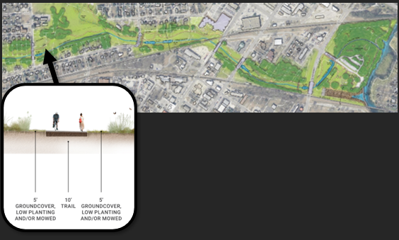
By coordinating bridges, restored passage and trails with the channel improvements, the project extends the value of the flood-mitigation investment into everyday community use.
The proposed overflow spillway near Children’s Park illustrates how the same land can serve different purposes. During ordinary conditions, it would appear as a gently sloped native-grass landscape. During larger storms, it would provide high flows with a more direct route to the San Marcos River. Deep-rooted grasses will stabilize the ground, while stepped stones and a plunge pool will dissipate flows before they enter the river.
Instead of reserving this land exclusively for storm events, the project would create open space residents can experience throughout the year. Trails, bridges, habitat and connections to the well-established Children’s Park and Rio Vista Park will make the corridor an everyday community asset while preserving its flood-management role.
Public use is one of the clearest ways the project broadens the value of the City’s investment.
A Transferable Approach for Municipalities
Purgatory Creek demonstrates how municipalities can approach an urban stream as infrastructure, a natural system and public space. By considering those functions together, communities can identify opportunities that may be missed when flooding, drainage, mobility, utilities, parks and environmental restoration are planned independently.
That broader approach begins with asking the right questions early: What infrastructure and community needs intersect the corridor? Which natural functions can be restored? Can land required for flood management also provide parkland, trails or neighborhood connections? Which project elements can serve more than one purpose? What will be required to operate and maintain the improvements over time?
The answers will differ from one community to another based on stream conditions, soils, development patterns, environmental requirements and local priorities. The value of Purgatory Creek as a model is not in replicating its design feature for feature, but in applying the same integrated planning mindset.
By coordinating flood mitigation, stream restoration, infrastructure and public use, San Marcos is working to address an urgent need while creating broader, long-term community value. The lesson for other municipalities is that major public investments can accomplish more when communities begin with a wider view of what a creek corridor can become.
This article is based on “Purgatory Creek Improvements: A Holistic Design Approach,” presented by Amir Ahmadi, Ph.D., P.E., CFM, and Laura Casset, P.E., CFM, CPESC, at APWA PWX 2026 in Houston.

Laura Casset, PE, CFM, CPESC, is a vice president and stormwater practice leader with 23 years of civil engineering experience in stormwater management, floodplain management, flood mitigation, stream restoration, and hazard mitigation planning.

Dr. Amir Ahmadi, PE, CFM, is a project manager with 10 years of experience in stormwater infrastructure, roadway drainage, channel improvements, and hydrologic and hydraulic modeling.
Related Services
Explore Stormwater → Planning, design and engineering services for stormwater infrastructure that reduce flood risk, improve drainage and strengthen community resilience.
Explore Insights